Narrawong River Area
The best areas for launching into the Surry River are around the Narrawong boat ramp as there is ample parking and good access for vehicle to the river.
Bridgewater Lakes
Another popular spot to canoe or water ski is the picturesque Bridgewater Lakes. These fresh water lakes are sheltered, which makes it perfect for picnics, swimming, water-skiing, fishing, canoeing and boating. A boat ramp is located near the Aquatic Club.
Glenelg River Area
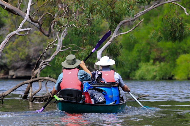
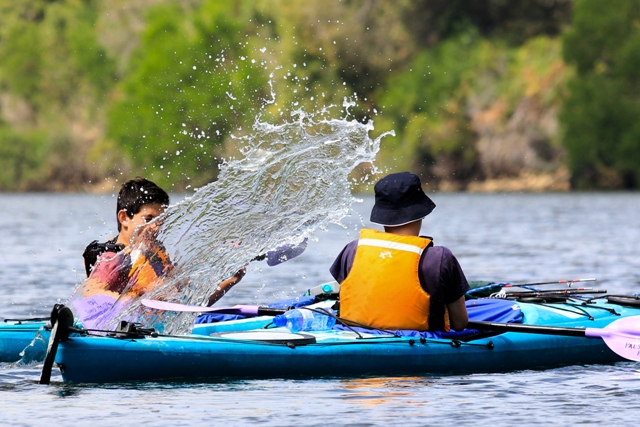
Canoeing the Glenelg River is a lovely four to Five day escape. Sections of the 75 km river between Dartmoor and Nelson can be attempted. Below we have listed the camp sites and canoe landings. A variety of sites have vehicle access to assist with planning your Glenelg River adventure. this travel guide has been developed with a start point at Dartmoor travelling down the river to Nelson. using Nelson as a start point will reverse the order of these sites. Canoe hire is available in Nelson and delivery/collection from most sites is available. Alternately canoes can be hired at Winnap. Paddle boats can also be hired for shorter trips to the river mouth form Nelson.
For maps and full details the Parks Victoria web site www.parkweb.vic.gov
To book camp sites along the river which is a requirement for camping at these site please see www.parkstay.vic.gov.au/accommodation.asp
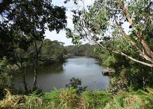
The Glenelg river flows through the 21,300 hectares of the Lower Glenelg National Park which was created in 1968 to preserve the lower reaches, and the most spectacular part of the Glenelg River – the limestone gorges began 25-40 million years ago. The region was once submerged by a shallow sea, and over millions of years , marine deposits and sediments settled on the bottom of the ocean. This was slowly compressed to form limestone rock and combined with the lowering of the sea level, this spectacular gorge area was created.
the river is also fundamentally responsible for creating the Princess Margaret Caves. This spectacular show cave runs guided tours displaying living examples of stalagmites and helictites. Fishermen may catch mullet, salmon, runs of bream, perch and mulloway. The best way to see this region is from the river.
Dartmoor ( Fort O’Hare) to Pines Landing
Total distance 18.7km
Distance from Nelson 73 km
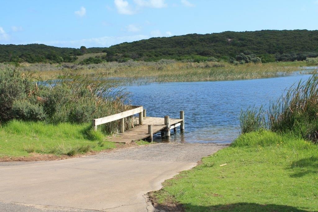
Both Fort O’Hare and Pines Landing have canoe camp areas where camping is permitted for boat users. Permits are required form Park Victoria if you wish to camp at any of the landing sites. Pine’s landing is accessible by vehicles from the Hedditch Track off the Winap Nelson Road south of Drik Drik. This section of the river is prone to snags and all boaters should be cautious along this section.
Pines Landing to Moleside Landing
Total Distance 4 km
Distance from Dartmoor 22.7 km
Distance from Nelson 69 km.
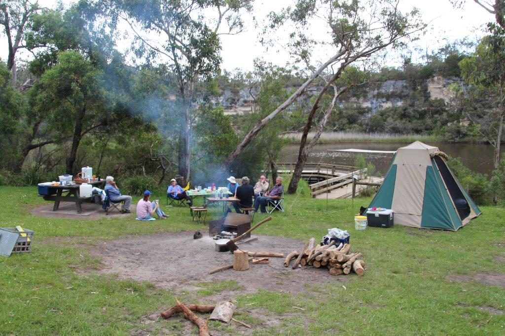
Moleside Landing is a well equip camp site for boaters with toilet facilities, fireplaces and picnic tables. This area is accessible by vehicles and is the last campsite where canoes can be launched until Pritchards (9.4) Moleside is a great overnight stop if canoeing the full distance.
Moleside Landing to Wild Dog Bend
Total Distance 2.8 km
Distance from Dartmoor 25.5
Distance from Nelson 66.2 km
Wild Dog bend has a well equip vehicle camp including picnic area, fireplaces and toilets. A landing is available to secure boats. There are no launch facilities at this site.
Wild Dog Bend to Saunders Landing
Total Distance 4 km
Distance from Dartmoor 29.5 km
Distance from Nelson 43.5 km
Leaving Wild Dog Bend the speed limit is increased to 10 knots and both canoes and recreational boats need to be more aware of other river users for safety. Saunders Landing supplies a lovely stop for lunch or a simple stop. There si launch facilities, fireplace and picnic area with toilets. Vehicles can access the area. Camping at this suite is not permitted.
Saunders Landing to Pritchards
Total Distance 3.2 km
Distance from Dartmoor 32.7 km
Distance from Nelson 40.3 km
Pritchards is a suitable point for launching both canoes and larger boats. Pritchards can be used as a base for camping, fishing and water skiing as it boasts an array of facilities including a caravan park and jetty/landing. Pritchards is well worth considering as an overnight stop for canoes.
Pritchards to Skipworth Springs
Total Distance 3.7 km
Distance fro Dartmoor 36.4 km
Distance from Nelson 36.6 km
Skipworth Springs marks the half way point of the river between Dartmoor and Nelson. This lovely landing allows for camping for canoes.
Skipworth Springs to Batterbys
Total Distance 4 km
Distance from Dartmoor 40.4 km
Distance from Nelson 32.6 km
Batterbys offers a fantastic vehicle camp with toilets, fireplaces and picnic tables. Batterbys offers a jetty/ landing as there is no launch area at the camp.
Batterbys to Georges Rest
Total Distance 0.8 km
Distance from Dartmoor 41.2 km
Distance from Nelson 31.8 km
Georges Rest offers a good alternative for water craft to the Battersbys site. Situated across the river from Battersby the proximity is close enough to utilise the Butterby facilities whilst giving access to a minor launch, canoe camp and jetty/ landing.
Georges Rest to Red Gum
Total Distance 1km
Distance from Dartmoor 42.2 km
Distance from Nelson 30.8 km
Between Georges Rest and Red Gum is the landing Popeyes, no camping or facilities are available at this landing. Red gum offers another vehicle camp and though there is no launch available there are other camp facilities.
Red Gum to Forest Camp & Forest Camp North
Total Distance 1.6 km
Distance from Dartmoor 43.8 km
Distance from Nelson 32.4 km
Forest Camp is a fully equip vehicle based camp with launch facilities available on the north side of the river. (Forest Camp North) a designated canoe camp is based at Forest Camp and Forest Camp North are advisable as good overnight camps.
Forest Camp & Forest Camp North to Wilson’s Hill
Total Distance 4.7 km
Distance from Dartmoor 48.5 km
Distance from Nelson 27.7 km
This length of river has a landing point, Deutchers which is not a permitted camp ground. Wilson’s Hill offers vehicle based camping with good launch and full facilities for a comfortable overnight stop after one of the longest lengths of the river.
Wilson’s Hill to Sapling Creek
Total Distance 0.4 km
Distance from Dartmoor 48.9 km
Distance from Nelson 27.3 km
Sapling Creek offers a good day stop or launch point for fishing and day trips. This launch has no camping available. The minor launch has a toilet, cooking and picnic facilities along with a landing and good road access.
Sapling Creek to Bowds
Total Distance 1.9 km
Distance from Dartmoor 50.8 km
Distance from Nelson 25.4 km
The camp at Bowds offers no camp site facilities other than launch and landing. This is a secluded camp with limited vehicle access offering the tranquil setting that other camps may not give for those not needing extra this is a wonderful stop.
Bowds to McLennan’s Punt
Total Distance 1.2 km
Distance from Dartmoor 52 km
Distance from Nelson 24.2 km
Mc Lennans Punt provides another camp site with a good range of facilities. Boasting all camping needs it does not have a launch only a landing site. The lack of lunch at this site makes it a good day stop and backup site for those camping at the camps either side (Bowds & Patterson’s) with fewer facilities.
Mc Lennan’s Punt to Patterson Canoe Camp
Total Distance 1.4 km
Distance from Dartmoor 53.4 km
Distance from Nelson 22.8 km
Patterson’s Canoe Camp provides a small canoe launch sand a quiet site for canoe camping a landing is the only other facility at this site, toilets and other facilities can be found at Mc Lennon’s Punt & Hutchison’s. Patterson’s provides the last canoe camp site until Lasletts (5km).
Patterson’s Camp to Hutchessons
Total Distance 1.3 km
Distance from Dartmoor 54.7 km
Distance from Nelson 21.5 km
Hutchesson’s has no launch ramps, it makes up for this with a full range of other facilities. Vehicle based camping is allowed and this is thee last camping site before entering one of the two advised water skiing sections. Lasset’s (3.7 km) is the next camping option.
Hutchesson’s to Sandy Waterholes
Total Distance 2.7 km
Distance from Dartmoor 57.4 km
Distance from Nelson 18.8 km
Sandy Waterholes site is the only launch within the recommended water skiing section of this part of the river. No camping is allowed at this site. The site provides a good day stop with fire places, picnic area and toilets.
Sandy Waterholes to Laslett’s
Total Distance 1 km
Distance from Dartmoor 58.4 km
Distance form Nelson 17.8 km
Laslett’s provides the last Parks Victoria camp site along the river. Having no launch facilities the landing is the only facility at this site.
Laslett’s to Princess Margaret Rose Caves.
Total Distance 2.2 km
Distance from Dartmoor 60.6 km
Distance from Nelson 15.6 km
The Princess Margaret Rose Caves provide the last listed camp site along the river. The site has no launch facilities but a large landing is provided. Prior to the Princess Margaret Rose Caves also marks the end of the recommended water skiing area and the beginning of the 8 knot zone begins down stream from the caves landing.
Princess Margaret Rose Caves to Donovans Landing
Total Distance 5.8 km
Distance from Dartmoor 65.2 km
Distance from Nelson 11 km
After leaving the Princess Margaret Rose Caves the river crosses into South Australia at Dry Creek ( 3 km from PMRC) at this point you have left the Lower Glenelg National Park. River side camping is possible along this section of the river. It is important to note that the land along the river may be privately owned and permission may be required. Donovan’s Landing provides a launch site and toilets.
Donovan’s Landing to Simpson’s Landing
Total Distance 5.8 km
Distance from Dartmoor 71 km
Distance from Nelson 5.2 km
This section of the river enters back into the Lower Glenelg National Park at Chapman’s (1.6 km) then shortly after the Taylor’s Straight water skiing section begins ending at Simpson’s Landing. Simpson’s Landing signifies the outer edge of Nelson and provides a launch, landing, toilets and a picnic area.
Simpson’s Landing to Nelson Landing
 Total Distance 2 km
Distance from Dartmoor 73 km
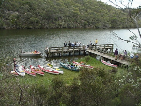
Nelson provides three landing areas for canoes. The Isle of Bags is a canoe only launch and the other two launch sites at the river boat dock and Information Centre are suitable for launching boats.
Nelson Landing to River Mouth
Total Distance 2.2 km
This stretch provides a good short section for those who do not want or may not be able to complete the full length of the river. The Mud Lakes at the river mouth are prohibited area and all boaters are asked to stay out of this area